Wales Coast Path: Cardigan to Moylgrove

16 May 2023 – 14.3 miles

This section of the Coast Path is flagged up in the guide book as being hard going – long, with ups and downs and not many ‘escape routes’. There’s also no public transport nearby. I’d had a look on Google street view to find a suitable parking spot south of the river Teifi, but on the morning when we got there, the little street parking there was was full, so we headed back to Cardigan and parked pretty much where we had been yesterday – added perhaps half a mile on, but it was convenient.

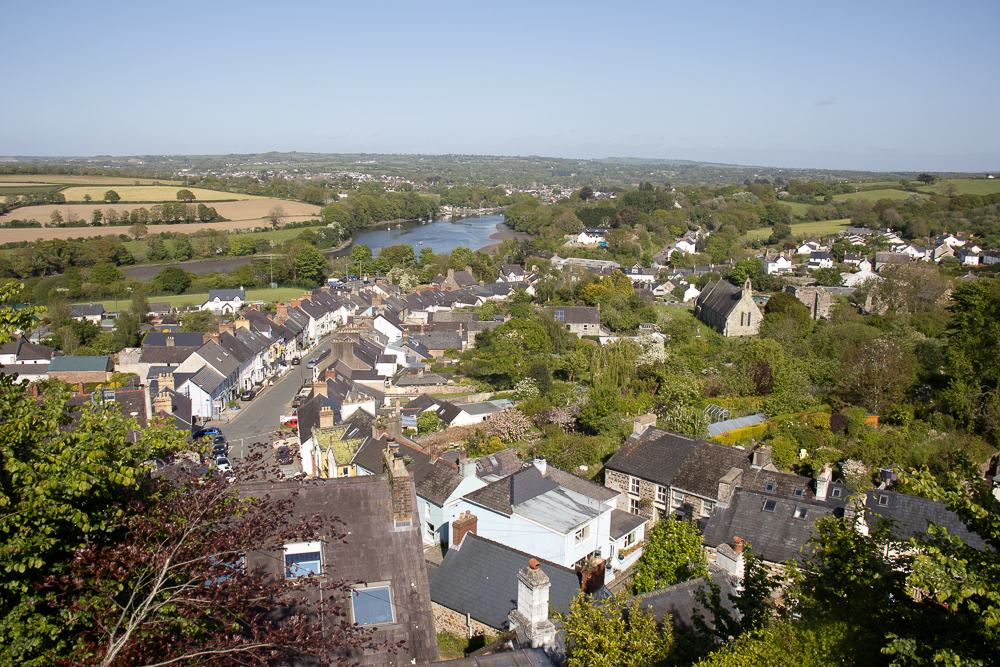
Another nice day. Headed south out of Cardigan and across the bridge. The path wasn’t terribly well signposted, but headed between houses up and over fields – some full of flowering clover – to St Dogmaels and the abbey, which we had visited on a previous occasion.

St Dogmael?

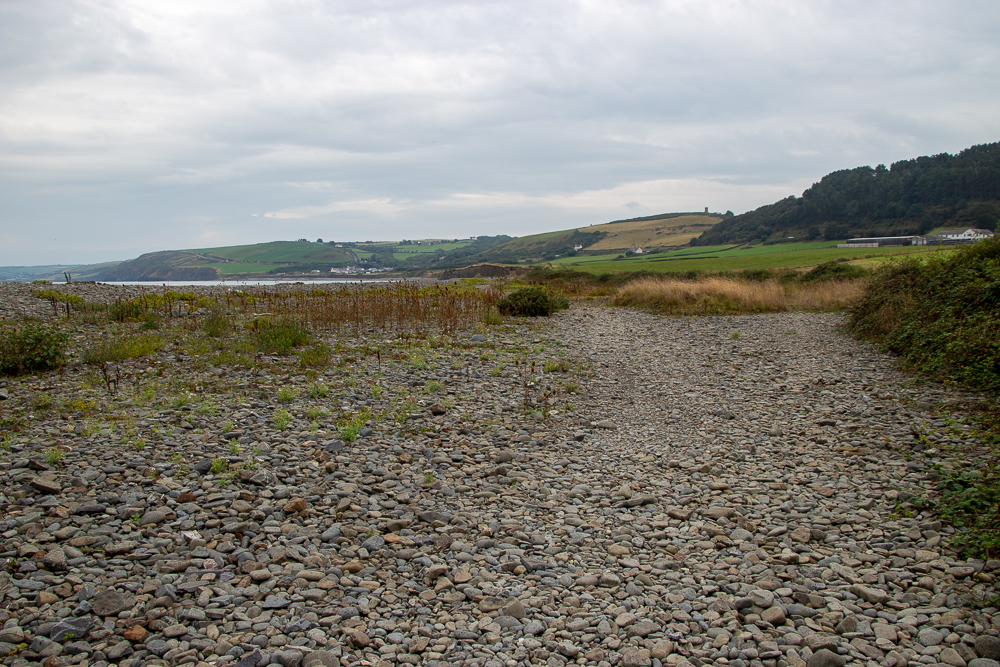
A short footpath took us down to the river bank and the start of the Pembrokeshire Coast Path (or the plaque marking it) and then it was a lot of road walking.

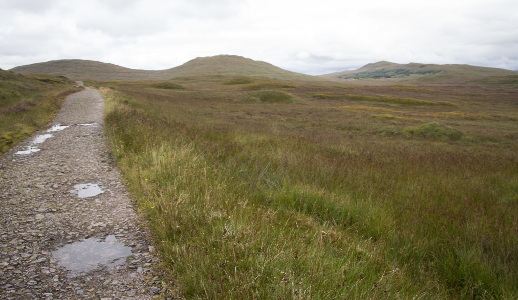
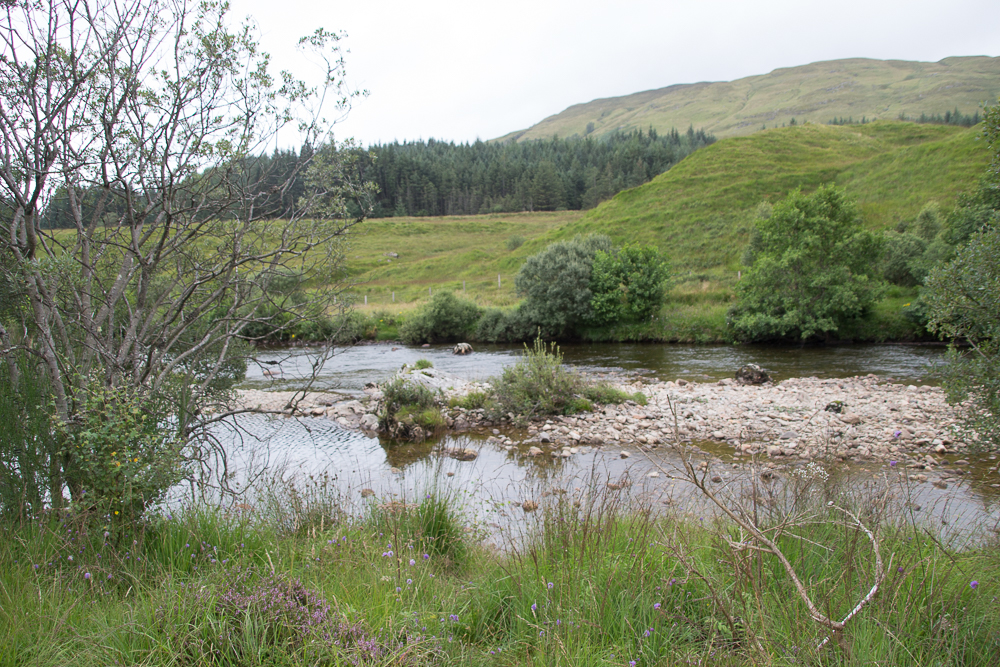
It wasn’t too busy, although it was mid-week and not the main holiday season, and was fairly open with views of the river and out towards the estuary. It was nice to see the same view as yesterday from the opposite side. This turned out to be Poppit Sands, which was a familiar name as there is a Youth Hostel here (although when we looked earlier in the year, they were taking rent-a-hostel bookings only. I’m told they open up bookings to individuals later, but that isn’t’ much use if you want to plan in advance …).

View of Poppit Sands

Moan over.

Up the steep narrow road, past the Youth Hostel to a farm and campsite with some amusing signs, and ‘Gate no. 1’. I don’t think we saw any others – are there any?

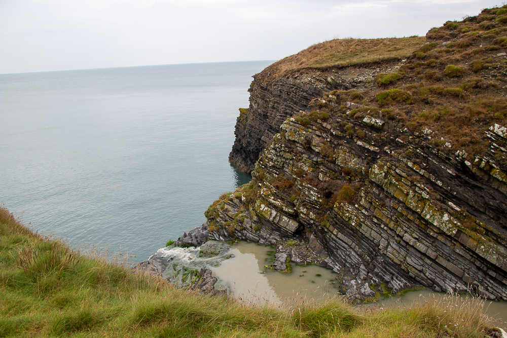
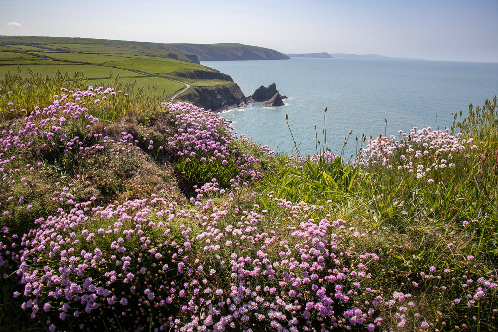
On to the cliffs at last and time for a welcome lunch stop. It seemed to have taken a long time to get here, but we hadn’t seen any other walkers. I seem to remember there were a couple here who just moved off from their lunch stop as we arrived. From then on it was spectacular cliff top walking all afternoon. It didn’t seem particularly hard going – it was rolling, but not too many big ups and downs compared with some other stretches. And although we were at the top of some high cliffs, it wasn’t particularly scary, even for me!

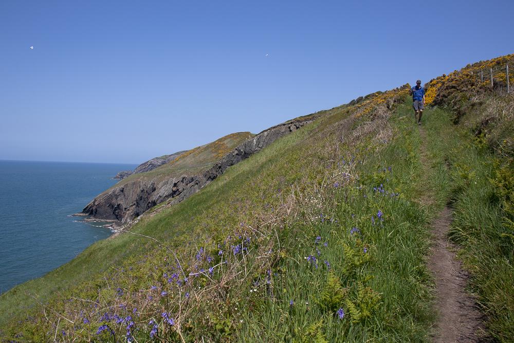
Interesting geology presumably, if you know about that sort of thing, with folds and waves in the cliffs.

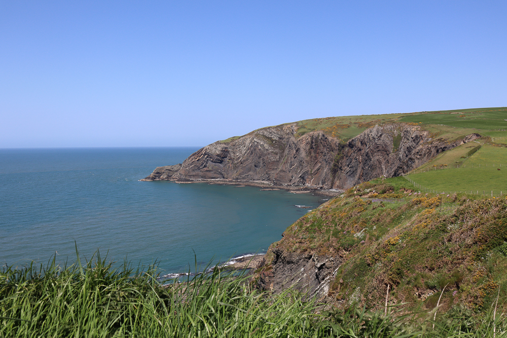
We reached the small Ceibwr Bay that can be accessed by a small road.

Ceibwr Bay

We headed inland, intending to take the path up the valley to the road, but then saw a signpost directing us to a garden centre with café – what a welcome stop that was! We then followed quiet roads back to St Dogmaels and then to Cardigan.

St Dogmaels and River Teifi

The last part seemed to go on longer than expected, but we made it.

Wales Coast Path: Moel y Don to Menai Bridge

10 October 2022 – 12 miles

We stayed a couple of nights at Conway Youth Hostel to give us a range of options to do the final section of the walk around Anglesey. As it was, we chose a beautiful day, warm, clear and sunny. On the map, this section looks rather disappointing, having to detour inland around the Plas Newydd estate., but it had its compensations. After a walk up from the coast on quiet lanes, we were very near to the burial cairn of Bryn Celli Ddu. There were only a few people there, who soon left, so we were able to have a good visit and take in the atmosphere.

We then met a walker who asked about the path, saying it was a bit tricky to follow. It didn’t seem too bad in the direction we were heading, although it wasn’t that clear across fields of long grass with old fence posts and wire lying hidden there! The next section ran in a separate path alongside the A road. Not that bad as you were separated from it by a hedge.

It wasn’t too long though before we were thankfully back on the coast once more. A path through the woods led down to the hamlet of Pwll Fanogl, with what looked like a restored mill.

A raised path led alongside the sea wall for a short way passing a pier with Ministry of Defence warnings on it. This seemed unlikely, but we were passing the grounds of the Joint Services Training Centre.

There were good views of the Menai Bridge, and of the statue of Nelson, standing slightly out into the water.

We then had to head slightly inland again, through an old churchyard and under the Menai Bridge. There were some boats out in the straits under the bridge, which we assumed were on exercises from the training centre. The current was running very fast, swelling up against the piers of the bridge.

Shortly before reaching the town of Menai Bridge, we came across Church Island, linked to the mainland by a short causeway, so we made a detour to explore.

A little further on took us under Britannia Bridge and completed our circuit of Anglesey.

We returned the way we had come, minus the detours.

Wales Coast Path: St Bride’s to Broad Haven

23 September 2021 – 11.5 miles

We parked in the small car park at St Bride’s near the small beach and cove and set off north and east. I started off wearing my thin fleece for perhaps the first time on this holiday – it was quite chilly – but took it off after about half an hour.

The path was very quiet today. There were great views across St Bride’s Bay towards St David’s. We saw a couple of gannets – surprisingly, they were the first we had seen this holiday – and some more seal pups. Still lots of bees and butterflies in the meadows and hedgerows.

The coastline is small rocky bays with dark red offshore rocks. The path itself stayed quite close to the coast itself. We found a small area off the path to have lunch and found a very convenient stone bench!

We walked down to Little Haven then along the beach to the far end of Broad Haven as the tide was well out. It is a big beach, so didn’t seem at all busy, even though there were quite a few people out, mostly near the steps at Little Haven, and a few viewing and exploring the huge cave that separates the two bays.

We walked back along the road/promenade. which is the official route for the Coastal Path, and had an ice-cream in Little Haven.

We then walked back up following the Coastal Path – it seemed far more up than I remember coming down! – until it met a minor road. We then followed quiet roads and footpaths more directly back to St Bride’s where we had a swim in the sheltered bay. The tide came in quite quickly – our clothes were just far enough up the beach to stay dry by the time we got out!

Wales Coast Path: Marloes to St Bride’s

View towards Skomer

Monday 20 September 2021 – 10 miles

We drove to the National Trust car park at Marloes and followed the path back down to the coast. It was reasonably level going today with views across jagged rocks on the coast across to Skomer Island. Choughs were flying overhead.

We looked down into one bay and saw three seals floating in the water. A little further on someone told us there were pups in the next bay. You had to go right up to the fence and look straight down, but there were several, with a few adults.

We crossed a neck of land here – for some reason the coastal path doesn’t go right round the headland – and down to Martin’s Haven, where boat trips leave for Skomer Island. We stopped here for a drink and a snack, then saw another seal pup under the cliff – I’ve never seen any before!

We followed the path past small rocky headlands to Musselwick Sands. A couple coming up off the beach warned us it was very slippy going down at the bottom so I went down the rock-cut steps very gingerly. It actually wasn’t that bad, but just as well to be careful. We had lunch on the beach in the sunshine with views north to Snowdonia.

Heading back up to the top of the cliffs, we then walked to St Bride’s Haven. The view from here was to the north across St Bride’s Bay towards St David’s. There were quite a few cargo ships at anchor in the bay.

St Bride’s Bay

We had a glimpse of St Bride’s Castle from the coat path. I think it’s a 19th century mansion but is now part of the Holiday Property Bond. There were quite a few people in the small bay near the entrances.

St Bride’s Castle

From here were followed footpaths and lanes back to Marloes, where we had another coffee and cake in the café.

It hasn’t been a particularly long or difficult day, but we both felt tired. I think the walking over the past week is catching up on us, so  – rest day tomorrow!

Wales Coast Path: Dale to Marloes

Sunday 19th September 2021 – 13 miles

We are now staying in Dale, a tiny village on the Marloes peninsula in Pembrokeshire. After a grey and drizzly day yesterday when we travelled here, with a visit to St David’s, today it’s warm and sunny but with a stiff breeze – not as humid as Ceredigion either. It’s my first time in Pembrokeshire.

We walked from our house at the top of the village to the harbour, about 5 minutes away. Lots of small boats and dinghies heading out into the bay. You can just make out Milford Haven in the distance. We followed a lane up the hillside through woods, passing an interesting sculpture workshop.

Sculpture workshop

We met a large party of students, presumably heading down from the field studies centre which is up this road. We also met a runner who had a small dog running after him with its tongue hanging out! We turned and went across a couple of fields when the runner overtook up going in the opposite direction, the little dog still keeping up with him. We saw them again later on having a swim in the first small bay.

Dale peninsula

It was interesting heading round the peninsula as you see different views quite often. We saw the Irish ferry heading into Pembroke Dock.

Further round the peninsula there was an old blockhouse, now a holiday cottage, and a lighthouse plus coastguard lookout. It was surprising quite how many houses there were up here.

The path was mostly over rolling fields with a few up and downs to small bays. The rocks are red here as opposed to the grey we had further north, and the headlands end in jagged rocks.

Coastal cliffs

I was very pleased to come across the stone at Bull Bay marking the place where Henry Tudor had landed in 1485, on his way to the battle of Bosworth Field and becoming Henry VII. It seems such a strange, remote place to land, but apparently he had supporters here (having been born in Pembroke and from a local family) and was avoiding more populous areas where there could have been forces on the lookout for him.

Henry Tudor’s landing place

By early afternoon we came to a path leading back to Dale – we could see our cottage and the far harbour. Behind us was a small bay. We had already decided to go on a bit further, as the circular walk back to Dale would have been a bit too short.

We follow the cliffs round past a disused airfield – mostly roads and runways on the ground, then we had a great view northward to Marloes sands.

We headed inland here, checked out the National Trust car park, and had a welcome coffee and cake before following lanes back to Dale.

Wales Coast Path: New Quay to Llanon

13 September 2021 – 11.5 miles

We are staying for a week’s holiday in New Quay with the intention of walking some of the Coast Path, but doing other things as well. As it turned out, the weather was fine and there wasn’t a great deal else to do nearby, so we did four days on the Coast Path.

It had poured overnight, and we awoke to heavy rain. However, the forecast said it would clear by ten, which it did. The day was hazy with a few odd spots of drizzle but never enough to even consider putting a coat on. It was quite warm and humid too.

We left our holiday let on the outskirts of New Quay and took the road which leads to the beach and a walk into New Quay. This time we continued a little further along the road to a farm. There was a confusing signpost here pointing in two different directions for the coast path – in hindsight, the post had turned round, and one finger should have pointed back the way we had come!

Looking back to New Quay

We followed the coast north, alongside hedges filled with blackberries and through woods just beginning to show autumn colours.

We had one big dip down to a small bridge over a stream which then dropped off over the edge of a cliff. I didn’t go to the edge to see the waterfall!

We reached Aberaeron in time for lunch – a nice little town with colourful houses around the harbour.

There was a bit of a walk along a rocky shore and then around the village of Aberarth.

Soon, we headed uphill again. Here, we saw a pod of dolphins in the bay. We stopped to watch and take a few distant photographs.

We headed for Llanon where we were going to catch a bus. There was a small car park and the option to head inland (I think it is difficult to cross the stream running down to the beach at times) but we continued along the rocky shore. There had been some attempt to prevent coastal erosion here, but it looks as if the sea is winning!

There were two sets of metal steps leading up off the beach, not very clearly signposted – we had to go up the first set to check before deciding it was the next lot we needed.

A land led through old cottages to the church (where there is a good parking area saying no parking!), and then to the main road. We had the best part of an hour to wait for the bus, but we did find a small, free car park round the corner, ideal for tomorrow!

North Cheshire Way: Alvanley to near the River Weaver

14 May 2021 – 12.3 miles

Lockdown was easing, and we wanted to go for a day’s walk, somewhere different, but not too far away. What about that North Cheshire Way we started? I looked it up (that’s why I keep a blog) and found it was over 8 years ago!

We found a parking spot in Alvanley village, couldn’t see the exact road junction we’d reached last time, but decided not too be too bothered about that. We passed the church, over fields, and over towards Helsby Hill, where we started to see a few other walkers.

Alvanley church

It wasn’t anywhere near as busy as wed expected on Helsby Hill. We stood and looked at the view of the Mersey plain, although it was rather too hazy for anything really impressive.

Helsby Hill

The path led around the hillside and through the woods, before crossing some more open fields and heading through the woods on Woodhouse Hill. It was one of those good, well-made paths that you keep heading along, until you realise that it isn’t waymarked and we were no longer on the North Cheshire Way (too busy being nosy at the posh houses!). We should have turned quite sharply right at the top of the steps! So back we went until we picked up the path again.

This led us to the War Memorial at the top of Frodsham Hill, where we sat and had lunch, with a small group of walkers already sitting on the benches. Good view again over Runcorn, the Ship Canal – not picturesque, but interesting, and it was good to be able to pick out different features.

The route skirted the edge of Frodsham. Although on the map it looked as though we would be going through built up areas, we hardly did. It felt fairly rural.

Path through the woods with bluebells and wild garlic

For the final part, we crossed flat farmland. Here we went round all 4 sides of a field, trying to make sense of the map, the GPS, and the footpath signs, until we realised we should be heading down the road/track. (We didn’t have a proper route on the GPS, plus I’m out of practice using it!). We finished by Belleair Farm, just a short way from the River Weaver, but a suitable turn-round spot.

We headed back up the lane to the main road. There is a large campsite on the corner and as we walked past a car towing a caravan missed the entrance and drove down the lane. As we walked out of sight we could just see him reversing back up the lane!

Only one unavoidable muddy section, near the end!

We walked back along mostly quiet country lanes, but made a bit of a mess with keeping on top of which junctions we had passed etc, with the result we walked up and back down a road, adding an unnecessary mile or so onto the day. Still, it was good to get out again, and the path today was much nicer and more interesting than I remember the first section of the North Cheshire Way.

I’m off to have a refresher in how to use the GPS …

West Highland Way 6 – Kingshouse to Kinlochleven

Tuesday 14th August 2018

(A walk undertaken in 2018 but written up during Covid-19 lockdown and restrictions 2020)

I slept really well in my ‘Hobbit house’ at Glencoe ski resort. I had already filled the kettle in the lodge so I boiled that for coffee and had a banana and breakfast bar as the cafe doesn’t open until 9 (in retrospect I had plenty of time to stay for a late breakfast …).

I wore my midge net for the first time to go to the shower block. Everyone on site is wearing one. The midges didn’t seem too bad until I went to the tap to fill my drinks bottle and there were swarms of them. However, as soon as I set off down the drive (about 8:30), there was a good breeze and no need for the net.

Across the road to the Kings House Hotel, currently being rebuilt. The bunhouse looks almost complete and the showers and toilets were open for the wild campers to use. The hotel itself looks like the structure is almost complete.

Kingshouse building works

There was low cloud and some drizzle but the occasional glimpse of blue sky gave some cause for optimism.

I followed the old military road towards Glencoe, making quite slow progress and taking many photos. Every time the cloud moves, it looks different! None of the WHW runs alongside the road itself – a path has been created a short way in over the verge.

As I began to head uphill it began to rain – as opposed to drizzle – so out came the waterproof trousers. I had already zipped the legs back on to my walking trousers this morning as proof against the midges.

A very large bird circled overhead and I have written in my diary that I thought it could well have been an eagle. Zooming in once I got home, I thought it looked more like a heron which I thought unlikely until I read that they can be seen circling high overhead in hill areas! I haven’t seen any deer yet, although other walkers have said they’ve seen them in the distance.

Not an eagle …

Although it kept raining – not heavily but proper rain – I idd stop to look back at the amazing views of the Buchaille Etive Mor and the head of Glen Coe. It would certainly be worth another visit on a better day!

Despite the rain, I sat down for a short break on the cairn at the top of the Devil’s Staircase. I felt rather damp and I wonder if my coat needs reproofing. I also rolled up the bottoms of my trousers as they were soaking up water off the path. They are a bit long, plus they could do with a belt to keep them up better!

Once over the ridge, the rain ease up a bit and did stop not long afterwards, which was a bit of a relief – psychologically as much as anything.

A fairly rough mountain path led down – nothing tricky. There was a glimpse of Blackwater Reservoir, which we had walked to many years ago on my first trip to Scotland! I took a photograph and I was glad I had as a thin mist came down quite suddenly (and it went quite quickly too).

I had a couple of short stops for a bit to eat, but again, midges began to swarm around, so I kept moving. The path became a rough track, steep and zig-zagged which my legs really felt, but it then got easier. There is quite a long trek into Kinlochleven after the first sight of the houses. You pass some small reservoirs and the huge black pipes leading to the aluminium works. I also passed, and photographed, a waterfall which I think is the one I had my picture taken at when I was 20 and we walked up to the Blackwater Dam.

My hotel, the MacDonald is on the far side of town, so it felt a bit of a slog, but on the positive side, the path out tomorrow is just over the road. I got here just before 2 (so I could have had a leisurely breakfast) but they let my have my room. They weren’t sure if the bags were there yet, so I didn’t check until after three when it was there and it was good to change into clean dry clothes.

I was really tired today – rain, up and down a hill, a long day yesterday – it all adds up. There was one point on the Devil’s Staircase when I thought about changing into dry socks, but I couldn’t be bothered. When I met Penny later the following day, she had been the same with waterproof trousers. In retrospect, I realised how tired you are the day after a hard day, even without particularly feeling it. There’s a lot in your head, not just your legs.

View from the hotel bar

West Highland Way 5 – Tyndrum to Glencoe Ski Resort (Kingshouse)

Monday 13th August 2018

[A walk done in 2018 and written up during lockdown 2020]

I had a quick breakfast in the hostel with a cereal and yogurt pot and a breakfast bar that I had bought yesterday, then set off just before 8 a.m. for the long day ahead. There was low cloud as I left so I wore a coat, but put it away again quite soon.

It was good walking along an old road/farm track running along the valley with the main road and railway following the same route. There was one point when you go over the shoulder of a hill and you can see road signs showing that you are leaving Loch Lomond and the Trossachs, and entering Argyll and Bute – it just felt different somehow. Apparently, you cross the watershed here, as I will several times today, and entered a different valley. It felt good, feeling the landscape.

A bit of light rain and drizzle came on as I headed into Bridge of Orchy. I debated going into the hotel for coffee, or boycotting it after the dreadful and hideously expensive experience in their bunkhouse 20+ years ago. I decided a good rest would refresh me and set me up for the next stage. Quite a few people that I have met this journey were already there. I was really glad of the rest, toilet and the coffee and delicious scone! (they no longer have a bunkhouse, btw!)

The way then heads away from the road, initially through forest and over a hill with a great view of Loch Tulla. I think it was on this stretch that there was a single male walker ahead or behind me. I kept slowing down to let him overtake as I wanted to enjoy the landscape and wilderness alone, but he kept slowing down too. I realised after that he was probably doing the same and trying to let me get ahead.

The Way heads downhill to Inveroran where the Inn looked very nice, but closed and far too early for lunch anyway! You then follow the road up to a car park at Victoria Bridge, then soon you are on the old drove road – or Telford’s Parliamentary Road, according to the information panel.

I had decided I would have lot of breaks today to keep me going for the 17-18 miles, so I stopped and sat on the wall of a small bridge, but straight away, I got pestered by midges! I slathered myself in repellent and set off, munching from a pack of oatcakes in my pocket as I walked. I tried to stop again a bit later on a similar bridge, but the same thing happened, so I resigned myself to very short stops. I then reached another bridge where there was a bit of wind and it was mercifully midge-free. Some German ladies were also sitting here and I think they were amused at me sitting down, looking a bit tired. They asked, “Are you exhausted?” and wanted to know how long I’d been walking. They were amazed to hear I’d come from Tyndrum, said they were impressed and wished me good feet and strength!

The walk after Bridge of Orchy was wonderful – big hills all around and a sense of remoteness. The clouds were low enough to cover the tops, and it felt quite humd, but it gave lots of atmosphere. They Guide book says something like there are no sudden, spectacular views, but it’s all of a piece and you are part of the landscape and it is part of you. It sounds pretentious, but that is exactly how it felt, with nobody in sight for much of the time.

After a while, it felt like the path kept on going upwards and you never quite seemed to get to what had looked like the top. Then there was a cairn on the hillside (is this the memorial to Peter Fleming?) and you started to descend. The main road across Rannoch Moor came into view. The book and map were in my rucksack so I didn’t check how far it still was to go, but told myself it could be some way yet. I looked up a the hills, as you are meant to get a good view of Buchaille Etive Mor, then I thought, “I’m sure that’s it, in the cloud.” Then I saw a square of trees in the vallely, which looked like Kingshouse, and looked up, there was a ski-lift on the hillside. Not far to go now! And it really wasn’t although the midges were a bit thicker here.

It was a bit annoying to have to walk up hill, on the drive. I have a microlodge (hobbit hut) and it’s fine. I had been warned by reviews and brought my own mug as they have a kettle but nothing else.

I went out for a shower and the midges had gone – it is a bit windier. I sat in the cafe with a view out of the window of Buchaille, which occasionally peeps through the clouds. As I was ordering my food, the German couple arrived and asked if they could share my large table with a view (the group originally sitting there had just left), then Penny came along too and ate with us as well.

I have read some dreadful reviews of this place, but really it’s not that bad if you know wat to expect (e.g. no cups). The lodge is basic but clean, and well set out with lots of sockets. You pay for the showers, but they are hot and efficient.

It took just over 8 hours to get here, which was my optimistic forecast. The walking felt good. The easier day yesterday stood me in good stead.In retrospect, I looked back on this as my favourite day, although on the way home, the lady from Go Haggis asked if I had had good weather – if you have bad weather here, it can be your least favourite day!

West Highland Way 4: Inverarnan to Tyndrum

Sunday 12th August 2018

[solo walk in 2018, written up during Coronavirus lockdown 2020]

The hotel (Drovers Arms) didn’t serve breakfast until 8 on a Sunday, but I went down a bit earlier, thinking I could at least start on juice and cereal. Several other people had had the same idea. Staff were all ready and taking orders too. Good breakfast.

Drovers Inn

It had looked a bit damp when I first woke up and then began to rain properly, so I donned waterproof coat and trousers – it makes the rucksack lighter! Chatted at the door to a Scotsman who told me it was ‘dreich’ and did I know what that meant (yes). He pointed to the clouds to show it was clearing and it was only fine rain.

The Way leads along a good farm road for quite a way. You could hear the river below and you crossed several streams and waterfalls running down. I think you could hear the Falls of Falloch, but you didn’t get a view of them (we had visited them from the road on the far side of the river a few years earlier – definitely worth a look). As expected, the drizzle had mostly stopped, so the waterproof overtrousers came off!

There is a “sheep creep” taking the Way under the railway. I had heard about these but it was easy enough to get through by bending forwards slightly. The I could hear busy traffic on the A82 and was worried about getting across, but there’s a tunnel. This leads to the old military road, which was mostly good going if a bit rocky and uneven in places.

I seemed to get quite quickly to the Crianlarich turning which I reckon is about half way for today’s walk, and half way for the whole West Highland Way.

The Way then heads uphill into the pine forest. I didn’t see any of the red squirrels which are meant to be there,although there were plenty of eaten pine cones around. Also some interesting fungus. I drizzled on and off lightly, but the trees gave some protection so I didn’t really get wet.

Coming out of the forest near a railway viaduct, the Way crosses the road again. No tunnel this time, but the traffic was much quieter and it wasn’t a problem. It is now much more open with views to high hills, although the cloud was too low to see them properly.

I stopped to have a look at the remains of St Fillan’s Priory. They aren’t very exciting, but I didn’t want to get to Tyndrum ridiculously early. I met the NZ lady (Penny) there as well as she can’t get in to her B&B until 4 pm (I met her a few times over the course of today).

The last section seemed to be a long way. Looking at the map, I should have been prepared, but I had the idea I was “nearly there”! There were interesting things to go past though, such as the site of the Battle of Dalrigh and the Loch where Robert the Bruce’s sword is meant to lie.

An open space with a pillar marked an old lead-smelting area. People had built small columns of stones and I thought I’d add a pebble to one, which promptly collapsed! I put it on a smaller, sturdier one!

On the outskirts of Tyndrum there were a couple of people in the stream beside a caravan site. It looked rather as if they were doing some sort of river management, moving stones and earth but I found out later they were panning for gold or silver which can still be found there.

I arrived at By The Way hostel shortly before 3. It is a very nice place with a big kitchen/dining/sitting area. The West Highland Way runs immediately in front of the window, where I sat with a coffee and watched other walkers, some familiar, arriving in town.

I went into town and bought a few supplies for breakfast and lunch tomorrow, and then had lunch at the Tyndrum Inn. I found a small, free table and went to order food at the bar. A voice next to me said, “Is that Ruth?” It was Penny from NZ so she shared my table for dinner.

I felt a bit tired today – the legs felt heavy, and it felt hard to get going after a stop – although it wasn’t a hard walk and I took it fairly easy. I’m saving myself for the longest day to come tomorrow.