Baldersdale to Middleton-in-Teesdale

Wednesday, 3 April 2013 – 13.1 miles

Baldersdale Reservoir

Grassholme Reservoir

We parked at the car park near Grassholme Reservoir, a short distance from Middleton-in-Teesdale. Today’s walk was a figure of 8, starting in the middle. Another clear bright day, slightly warmer than the previous ones.

Snowy hills in Baldersdale

Snowy hills in Baldersdale

We set off south and uphill, soon getting into snow. A fairly pleasant walk over the hills to the next road, but a bit of a slog in the snow.

Drifted snow

Drifted snow

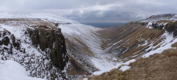
The next section took us past “Hannah’s Meadow” and High Birk Hatt Farm, where Hannah Hauxwell had lived, in a farm without electricity or running water. I do remember her being a bit of a celebrity when there was a series made about her in the 1970s although I never saw it. The traditional way the farm was run has led to the meadow being designated a site of Special Scientific Interest, crossed by a boardwalk.

Hannah's Meadow

Hannah’s Meadow

We walked across past two more reservoirs to a convenient turnaround spot by a waymarker, then returned to the car walking along minor roads (easier than the snow!). We hopscotched along the road with a farmer in a van putting out feed for the sheep at various points.

Farmer with sheep

Farmer with sheep

Over the hills we came across several curious brick structures, which we thought probably had something to do with mining, but we couldn’t work out what they were. (Found out later they are mining ventilation shafts)

Brownberry

Brownberry, with ventilation shaft

Stopped at the car to put on suncream, which we had forgotten earlier. I have caught the sun a bit, and after we went home, I was asked if I had been somewhere exotic over the Easter break …

We then followed the Pennine Way over the hills towards Middleton-in-Teesdale, passing a farmhouse with an impressive tracked vehicle outside, and a footpath filled by a snowdrift.

Family runaround?

Family runaround?

Just past here, I climbed over a gate that was blocked on one side by drifted snow, and promptly sank thigh deep when one foot touched the other side. I had to get Robby to push my other foot over the gate!

There's a footpath under here!

There’s a footpath under here!

At Middleton, we took a footpath over the hills, heading for the road. We came across what looked like an army exercise, seeing first a Range Rover with aerials sprouting from it, then several men in camouflage with large packs.

We returned to the car by road. It felt quite a long way, but again, easier than going over the snowy hills.

Middleton to Baldersdale


Langdon Beck to Middleton-in-Teesdale

Tuesday, 2nd April 2013 -17.3 miles

P1010260

Langdon Beck Youth Hostel

Stopping at Langdon Beck Youth Hostel, which only opened for the season today (which explains why we didn’t do this bit in the most logical order …). There is more snow here than at Dufton. It’s quite a bit higher.

P1010262

Tees Valley

The Pennine Way passes the Youth Hostel. We decided against our original plan of heading through the Pennines towards Dufton to join up the route, as the valley from this end looks just as snowy as where we gave up! So we headed south, following the Tees valley.

P1010264

We got slightly lost at one point, going right round a small hill, rather than across the top. On the return route, we worked out why. The paths from the farm were so full of snow, we just kept going rather than looking out for tracks heading off uphill. After that, it was fairly straightforward.

Trudging through snow - are we lost?

Trudging through snow – are we lost?

We passed High Force, (on the free side, without the car park, etc) – England’s highest waterfall, and somewhere I’ve often thought I’d like to visit. Pretty impressive today with massive icicles clinging to the rock faces either side!

High Force

High Force

We went through an area where they are concerned about a disease of juniper bushes, and we had to disinfect our boots before leaving.

Disinfecting boots

Disinfecting boots

More, but smaller, impressive falls further down the river. We moved slightly away from the river as we headed to the outskirts of Middleton-in-Teesdale, a very pleasant market town.

Lots of lapwings to be seen here

Lots of lapwings to be seen here

Returned by the same route. We saw more people on this route than the previous 2 days, mostly around High Force, but still very quiet.

Langdon Beck to Middleton

Dufton to Maize Beck

Easter Sunday, 31 March 2013 – 11.6 miles

Staying at Dufton Youth Hostel. The Pennine Way runs from the village. It was a cold bright morning, with snow on the upper fells, but the valley was clear and green with the daffodils in bud.

Dufton YH

Dufton YH

The Way leaves the village alongside a farm in a deep track which was where we met the first snow in deep drifts along one wall, but it was easily passable. Then the track headed uphill. The ground was frozen solid with a few icy puddles to be negotiated with care! As we headed higher there were views west across the Eden valley to the snow-covered Cumbria fells.

The path then reached the beginning of High Cup, which is a classic U-shaped glaciated valley. To think that when I did my O-level geography, I’d never seen one in real life! The path is fairly level and follows the high edge of the valley. There was a good covering of snow, but, although it had been trodden, it wasn’t compacted and it was easy walking.

High Cup pano

High Cup Nick

Impressive views from the head of the valley – a copy of ‘Country Walking’ magazine at the hostel had called this the best view in England. I’m not sure I’d go quite that far, but it could well be in the top 10!

The path then headed away from the valley, along the course of Maize Beck. It was completely covered in snow with no tracks other than a very faint and shallow set of footprints and maybe tyre tracks. We decided that these must be days old and have refilled with snow, but they gave us some visual clues as to the path. We followed this up to a bridge over the beck – although you wouldn’t have known there was a beck there! – and had lunch sitting on the snow-free steps.

Maize Beck

Maize Beck

After lunch, we crossed to the far side of the beck which was where the map placed the Pennine Way route, but within a couple of minutes, we encountered deep drifts. We went a little further along the side of the beck that we had come before, but although the snow wasn’t so deep here, we decided that it was sensible to turn back rather than struggle on for the sake of getting another mile under out belts.

Not being used to winter walking, we tried to see if there was any logic to which snow would hold you up, and which you sank into, but although we could see differences in texture, it didn’t seem to link to the hardness or otherwise of the snow.

On the way up, we had met a group of three people. Going down we met about four coming up, and were overtaken by a solo walker, who looked serious – we did wonder if he had come over the Pennine Way route, but didn’t see him later to ask.

Dufton to Maize Beck

Dufton to Maize Beck